Five Great Hikes in England’s West Midlands
Birmingham in central England makes an ideal base for walks in the West Midlands countryside. Midlands native Phoebe Taplin shares five of the best hikes in the region, each one rich in history and natural beauty.
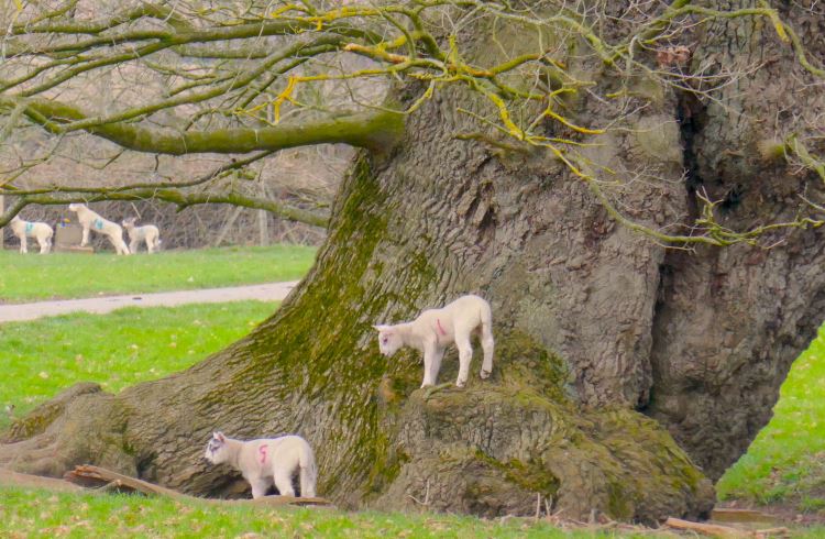 Photo © Phoebe Taplin
- Stratford-upon-Avon to Wootton Wawen
- Stourbridge to Kinver Edge along the canal
- Around the Roaches in Staffordshire
- Alveley to Bridgnorth along the River Severn
- Much Wenlock and Wenlock Edge
Skylarks are singing as they fly up from mud dotted with deer-prints. Spring lambs are climbing on the massive, mossy roots of a centuries-old oak tree. I’m hiking over hills where the short grass is patched with celandines, violets, and primroses and wide views stretch across Warwickshire and the Cotswolds.
Today’s walk begins, 40 minutes by rail from Birmingham, in Stratford-upon-Avon, William Shakespeare’s home town. Birmingham is a major city in a sprawling conurbation, but it actually makes a brilliant base for hiking through the underappreciated landscapes of the English midlands. These five trails showcase some of the area’s natural and historical treasures: wide rivers, aqueducts and gritstone crags, glass-makers, and cave-dwellers.
Stratford-upon-Avon to Wootton Wawen (11 miles/18 km)
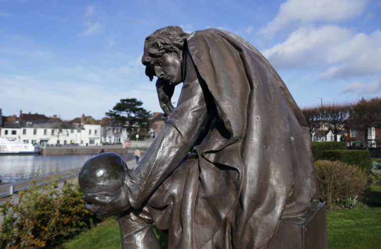
I grew up on the edge of the Midlands and my first job was teaching English in a big high school here. The waterside Royal Shakespeare Theatre in Stratford-upon-Avon was one of the closest theatres and the destination for dozens of school trips. But I feel closer to Shakespeare’s poetry out here in the Warwickshire countryside than in Stratford itself, with its coachloads of tourists and models of Big Ben for sale. The walk starts by climbing the Welcombe Hills, where a new audio trail marks four centuries since Shakespeare died.
I’m following part of the 625mi/1,005km Monarch’s Way, a long-distance footpath that traces the route of King Charles II as he fled Cromwellian forces after the Battle of Worcester in 1651. Lunch is garden salad and gooey treacle tart at a farm shop and café in Stratford: outside the café there are fields of baby goats and a Gloucestershire old spot pig churning up a paddock ready for this summer’s sunflowers. The last stretch of the route follows a canal-side towpath over an aqueduct to reach St Peter’s church in Wootton Wawen with its Saxon core, bearded Jacobean knight, and carved stone faces.
Hourly buses head back to Stratford from outside the church and the venerable, half-timbered Bull’s Head pub is nearby.
Stourbridge to Kinver Edge along the canal (8 miles/13km)
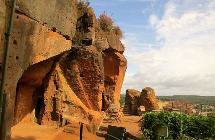
Bees are buzzing round the coconut-scented golden gorse and purple heather; red kites circle overhead as I look out from Kinver Edge towards the blue-green Malvern Hills. 250 million years ago, prehistoric winds whipped the dune and desert sands here into layers of soft, sunset-colored rock. Iron age settlers built a clifftop fort. Later, 17th-century workers carved homes into the rock itself, making comfortable houses inside the naturally summer-cool and winter-cosy sandstone.
My walk to the reconstructed rock houses follows canal towpaths from Stourbridge Town, 45 minutes by train from Birmingham. A new glass museum opened here in April 2022. Local coal for the super-hot furnaces and a supply of fireclay to line them made this area a natural location for Britain’s Victorian glassmakers. The canal network, built for industry, now provides peaceful walks through the countryside. Leaving the towpath, I head through fields and woods to Kinver. The National Trust is introducing longhorn cattle and clearing non-native conifers from an area of sandy heathland and wild ferny woods near the village. There are buses back to Stourbridge and cafés to refuel for the final climb to Kinver Edge.
Around the Roaches in Staffordshire (7 miles/11km)
For this spectacular hike, I head to the old textile town of Leek in Staffordshire. It’s 1½ hours’ drive from Birmingham, but the landscapes are worth it. This corner of the Peak District national park is a patchwork of waterfalls, blanket bogs, farmland, and high, craggy outcrops of wind-carved gritstone. After a breakfast of Staffordshire oatcakes (wholemeal pancakes with melted cheese), I walk half a mile up the road to the edge of the Peak District, which covers five counties and 555mi2/1,437km2. It became the UK's first national park in 1951.
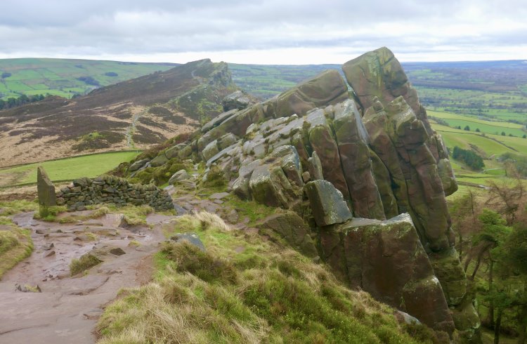
The walk continues beside the cascading River Churnet to Ramshaw Rocks. There are sheep grazing around gnarled trees and a ruined cottage; the damp air is rich with dung and woodsmoke. A flagstone path leads up through the heather past strangely shaped boulders.
Trekking west, I reach the high ridge of the Roaches. These long cliffs, which slope like a broken table, take their name for the French word for rocks. There are views across Cheshire, Lancashire, and Wales. I walk past the atmospheric clifftop Doxey Pool (said to be home to a sinister mermaid who grabs unwary travelers) and climb over Hen Cloud, a distinctive solitary hill. On the far side, an old stone farmhouse serves tea and it’s a short hike back to Leek.
Alveley to Bridgnorth along the River Severn (9 miles/14.5km)
The Severn Valley Railway is a restored steam railway between Bridgnorth and Kidderminster, 45 minutes from Birmingham by train. The line runs through 16mi/26km of countryside and is perfect for linear riverside walks along the long-distance Severn Way.
I tell the guard I want to get off the steam train at a tiny station in the Severn Valley Country Park on the site of what was once Alveley Colliery. Before setting off along the river, I follow a new history trail, opened in 2020, around the country park. These 126 rural acres once produced 300,000 tons of coal a year and the trail encounters traces of ropeways, spoil heaps, and miners’ cottages.
Today the wooded paths are thick with birds and berries: twisted wreaths of orange bryony and yellow hedges spangled with neon-pink spindle berries. Following the trail back over the River Severn, I set off for Bridgnorth, eight miles away upstream. The riverside path is grassy and inviting with mossy hawthorn trees and huge gaggles of mallards. Towards the end, there’s tea at Daniel’s Mill, a working 18th-century watermill near the Severn Valley Railway viaduct.
Much Wenlock and Wenlock Edge (6.25 miles/10km)
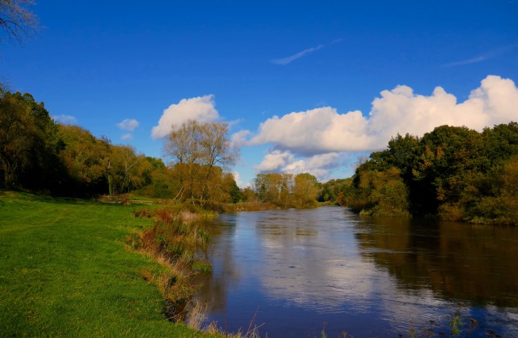
The Olympic Games were reborn in Much Wenlock, 50 minutes’ drive from Birmingham. In 1850, a pioneering Victorian doctor called William Penny Brookes founded a sporting society that eventually led to the first modern Olympic Games. One of the official mascots at the London 2012 Olympics was called “Wenlock” as a tribute to the little Shropshire town’s contribution and a mile-long Olympian Trail is now marked by bronze circles in Much Wenlock’s pavements.
After walking the trail, I hike an energetic short loop that includes Wenlock Edge, a wooded limestone escarpment above the town. I pass the ruined medieval priory with its towering thirteenth-century church under peaceful pines. Climbing to Wenlock Quarry, there are ivy-draped cliffs; fossilized seashells and hints of coral and trilobites are embedded in the rock. I walk down Blakeway Hollow, a deep, stony gully between banks of hart’s-tongue ferns and bracken with hedge maples, hawthorn, oak, beech, and silver birch tangling their branches overhead.
Another steep track leads up again, 1,000ft/305m above sea level, to look out across an extraordinary view where volcanic Shropshire hills form a misty backdrop to miles of hedge-chequered fields. There is a viewpoint known as Major’s Leap after royalist Major called Thomas Smallman, who galloped off the top of Wenlock Edge to his seeming-certain doom. The horse died, but the major lived (saved by an apple tree) and delivered his vital messages to the King’s army.
As I head back down towards Much Wenlock, a horse, framed by yellow leaves, watches me over a five-barred gate and the clifftop beeches glow fiery gold in the setting sun.
Related articles
Simple and flexible travel insurance
You can buy at home or while traveling, and claim online from anywhere in the world. With 150+ adventure activities covered and 24/7 emergency assistance.
Get a quote


No Comments